C.

CTRL+K: Wittgenstein and Hyperlinks

Wittgenstein portrait 1930
Would he have used hyperlinks?

Ludwig Wittgenstein’s Tractatus Logico-Philosophicus is the only book-length philosophical work published by the Austrian philosopher during his lifetime. It was an ambitious project, to identify the relationship between language and reality and to define the limits of science concluding: “Whereof one cannot speak, thereof one must be silent.” Wittgenstein wrote the Tractatus while he was a soldier and prisoner of war during World War I.

Die Welt ist alles was der Fall ist. (Manuscript)

Some years ago, Jonathan Laventhol created a hypertext version of the bilingual edition of the Tractatus as a private study aid. According to him, the reader will have to make up his own mind about whether such a tool helps or hinders the appreciation of the book.
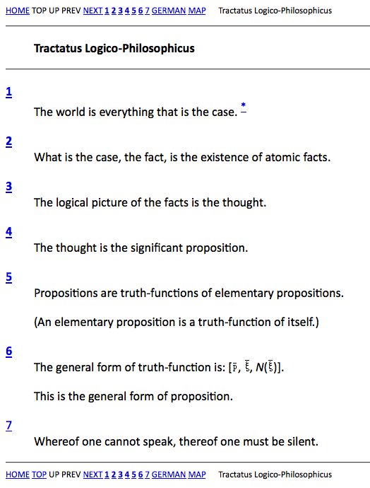
Die Welt ist alles, was der Fall ist.
Die Welt ist alles, was der Fall ist. (HTML)

Michele Pasin, a researcher in Humanities Computing at King’s College, London, created another visualization of the Tractatus, wich tries to give the text a novel visual representation using HTML and tabs. This is part of the PhiloSURFical project Pasin developed during his PhD studies at the Knowledge Media Institute.
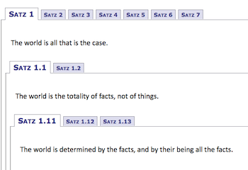
Die Welt ist alles was der Fall ist. (Tabs)

Althought the full text is online for free (www.gutenberg.org/ebooks/5740), maybe the best way to understand the text is still the book.

Well, you could also do what Bryan Magee did and ask someone like John Searle to explain a little bit further.

httpv://www.youtube.com/watch?v=qrmPq8pzG9Q

Finally, I am really not sure if Wittgenstein would have preferred hypertext to notebooks and papers. But I am convinced that different ways of exploring a text can enable the understanding.

I.

Imaginary Landscapes and Literary Maps

Did you ever wonder which of your favorite literary characters lived in the same street or were actually neighbors? Now you can find it out.

Visit the Literary Map of Manhattan to see where some 100 imaginary New Yorkers “lived, worked, played, drank, walked and looked at ducks.” In my opinion this is the best combination of maps and literature so far.

Looking at ducks (c) www.nytimes.com

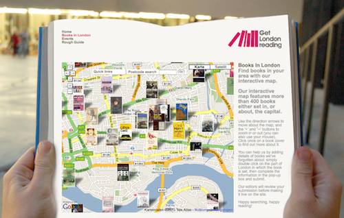
Across the Atlantic you can find a similar project called Books in London marking the location of more than 400 books either set in, or about, London.

Mapping the books. (c) www.getlondonreading.co.uk

The creators of Books in London also provide a free iPhone app of their literary map.

Augmented reality by bike.

Still another way to explore maps and literature is Gutenkarte. The so called “geographic text browser” is intended to help readers explore the spatial component of classic works of literature. Gutenkarte downloads public domain texts from Project Gutenberg, and stores all the geographic locations it can find locations in a database, along with citations into the text itself.

Tagging the world of War and Peace. (c) www.gutenkarte.org

You can also browse historical literary maps at the Library of Congress. This collection of maps was part of an exhibition entitled “Language of the Land“, a breathtaking journey through the literary heritage of the US.

The historical point of view. (c) www.loc.gov

Augmented reality is reality. And I am eager to see what is coming next.